

I had originally planned to hike some peaks in the Northern Monashees and explore Mabel Lake FSR, but my plans changed, so instead I decided on a day trip up Pinnacle Peak. Since I was already in Kelowna for the weekend, it worked out perfectly. I woke up at 4 a.m., was on the road by 4:45, and enjoyed the drive north. That stretch from Kelowna to Vernon is one of my favourites at sunrise, the view toward Kalamalka Lake from Oyama never disappoints.
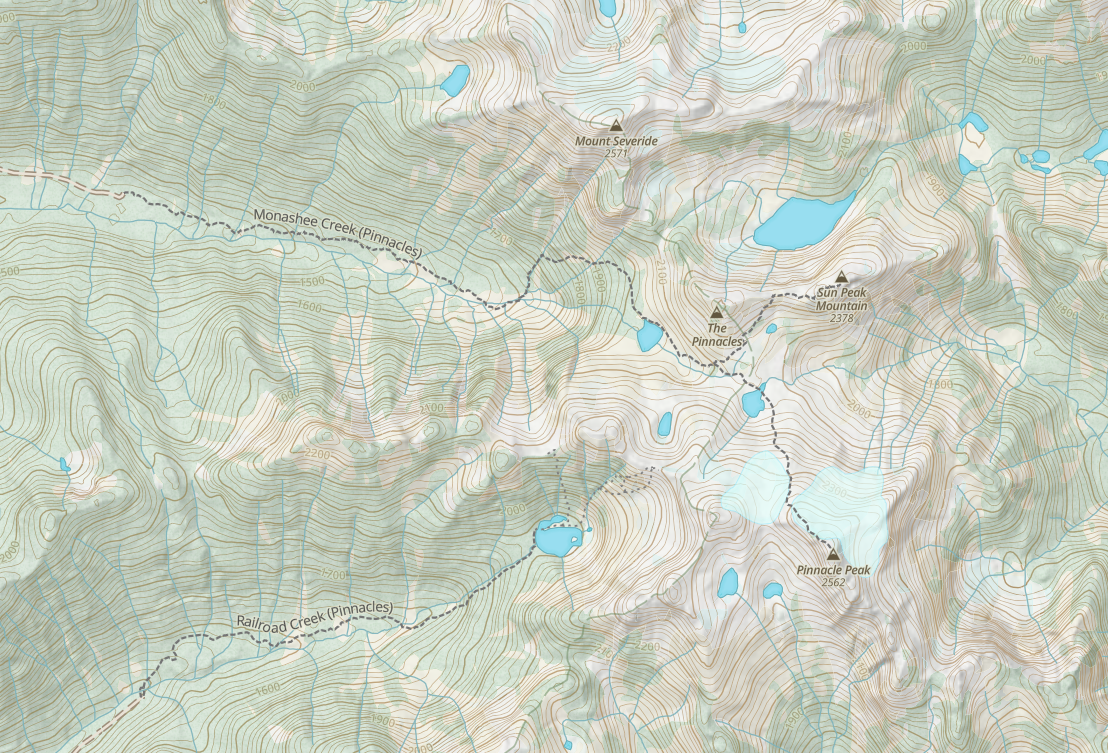
I don’t like heading into the backcountry without a full tank of gas, so I stopped in Cherryville, only to find both gas stations closed with no pay at the pump option. Luckily, I still had over half a tank, which was more than enough. From Kelowna, it took me about two hours to reach the trailhead, pulling in around 6:50 a.m. Google Maps tries to send you down a blocked turnoff for Monashee Creek Road, but the correct turn is just 30 seconds farther up the highway at 50.17825, -118.53677. From there, the road follows Monashee Creek Road for about 25 minutes before turning into South Fork FSR. At 50.209246, -118.345971, you turn left onto an unnamed spur. Thanks to the Vernon Outdoors Club, the route is well signed, making it easy to follow. The logging road is active and well maintained, any vehicle can make it. In fact, I even saw a low-rider Infiniti parked at the trailhead. A few bumps and potholes exist, but they’re easily avoided.
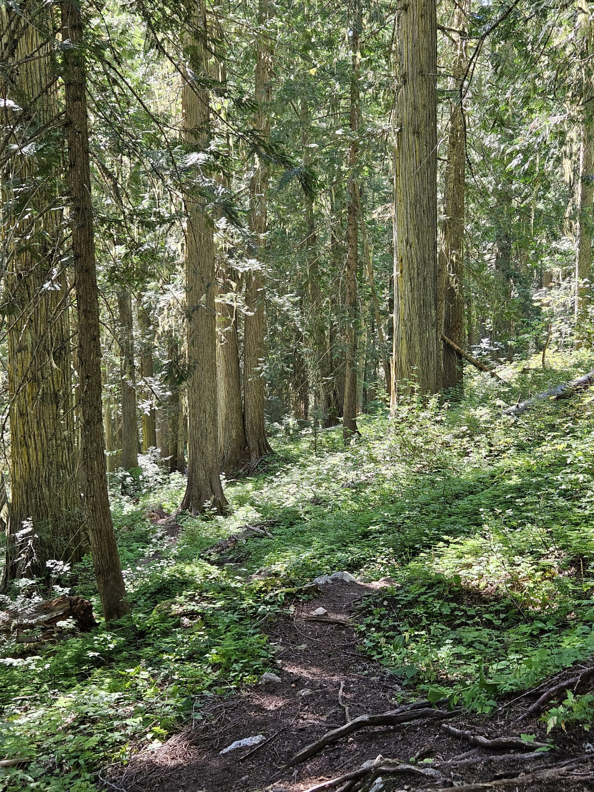
The trail begins at 1,340 m elevation. Essentials here include bear spray, mosquito repellent, and sunscreen, the latter of which I forgot, and I paid the price with a decent sunburn on my neck. The first three kilometers are fairly gentle, gaining only about 200 m, and pass through some stunning old-growth cedar with ferns carpeting the ground. The foliage in places is so thick it would be nearly impassable without the Vernon Outdoors Club’s (https://www.vernonoutdoorsclub.org/) hard work keeping the path clear. They’ve also marked the way thoroughly with flagging tape and orange (possibly red, my eyes couldn’t tell) diamonds, making navigation easy.
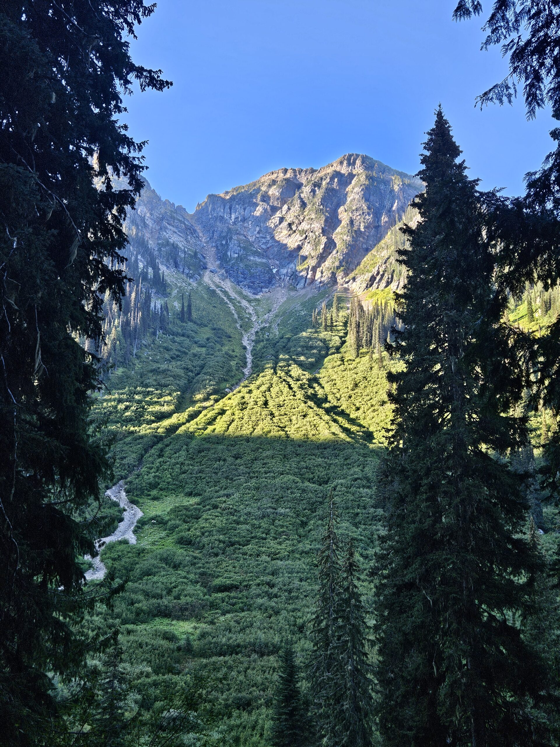
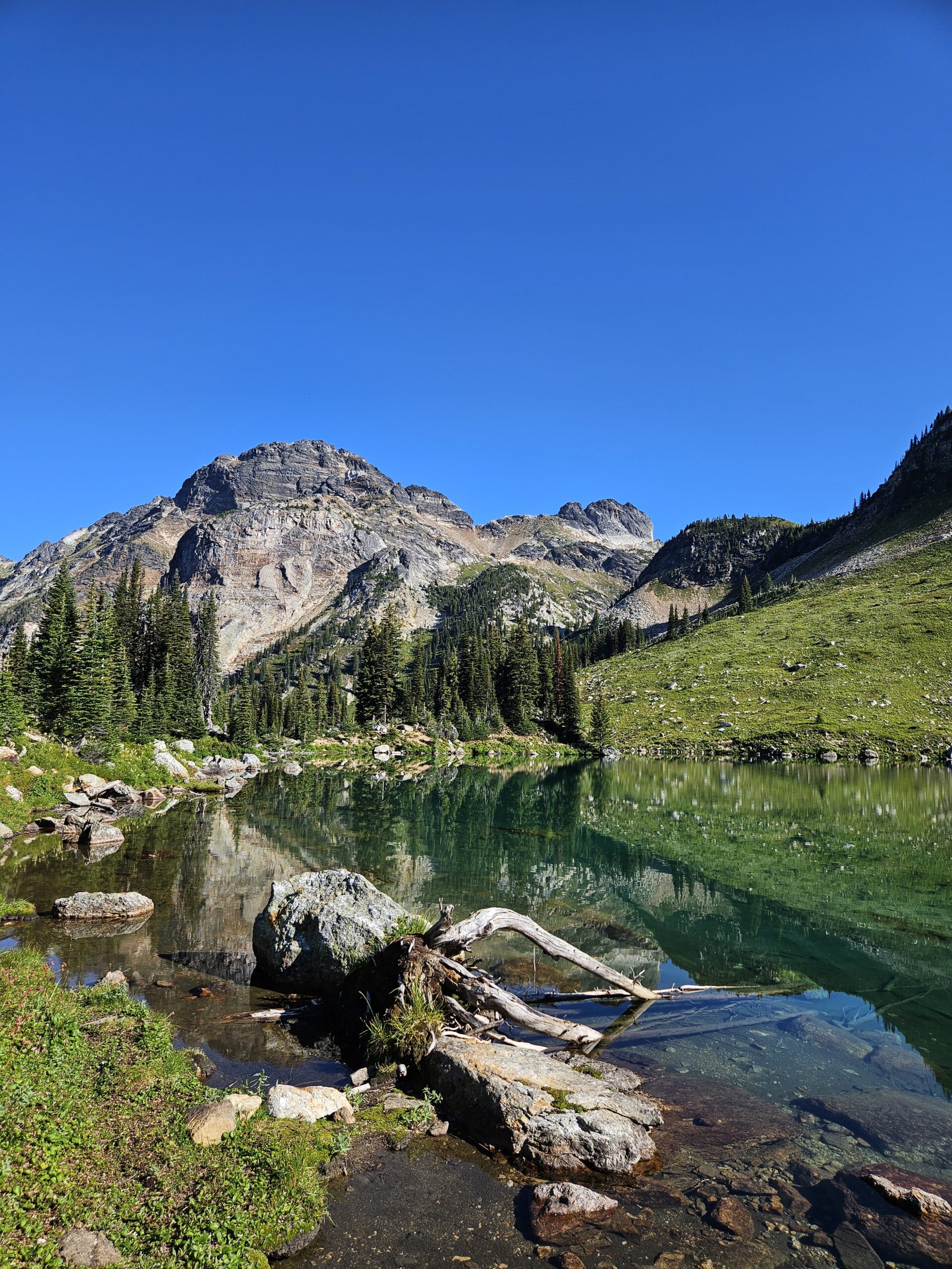
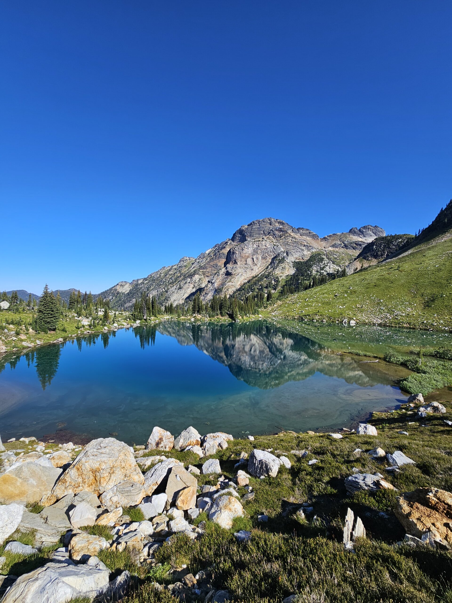
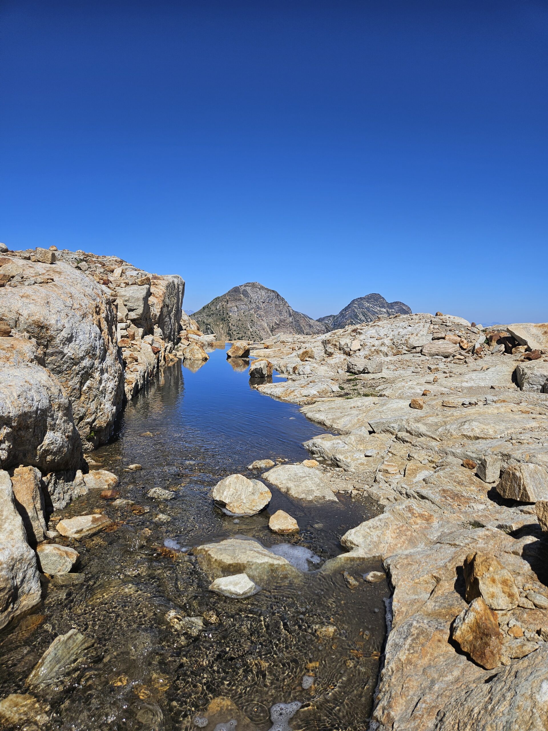
After this forested stretch, the trail climbs steeply, gaining nearly 500 m over just 1.5 km. The route leads up an avalanche chute and across the side of Mount Severide before reaching Monashee Lake. The climb is a grind, but the views are rewarding the entire way. Monashee Lake itself is small but striking. Its deep blue colour stands out dramatically against the surrounding peaks. A few makeshift campsites dot the west shore, but there are no facilities so make sure to bring proper food storage and pooping equipment.
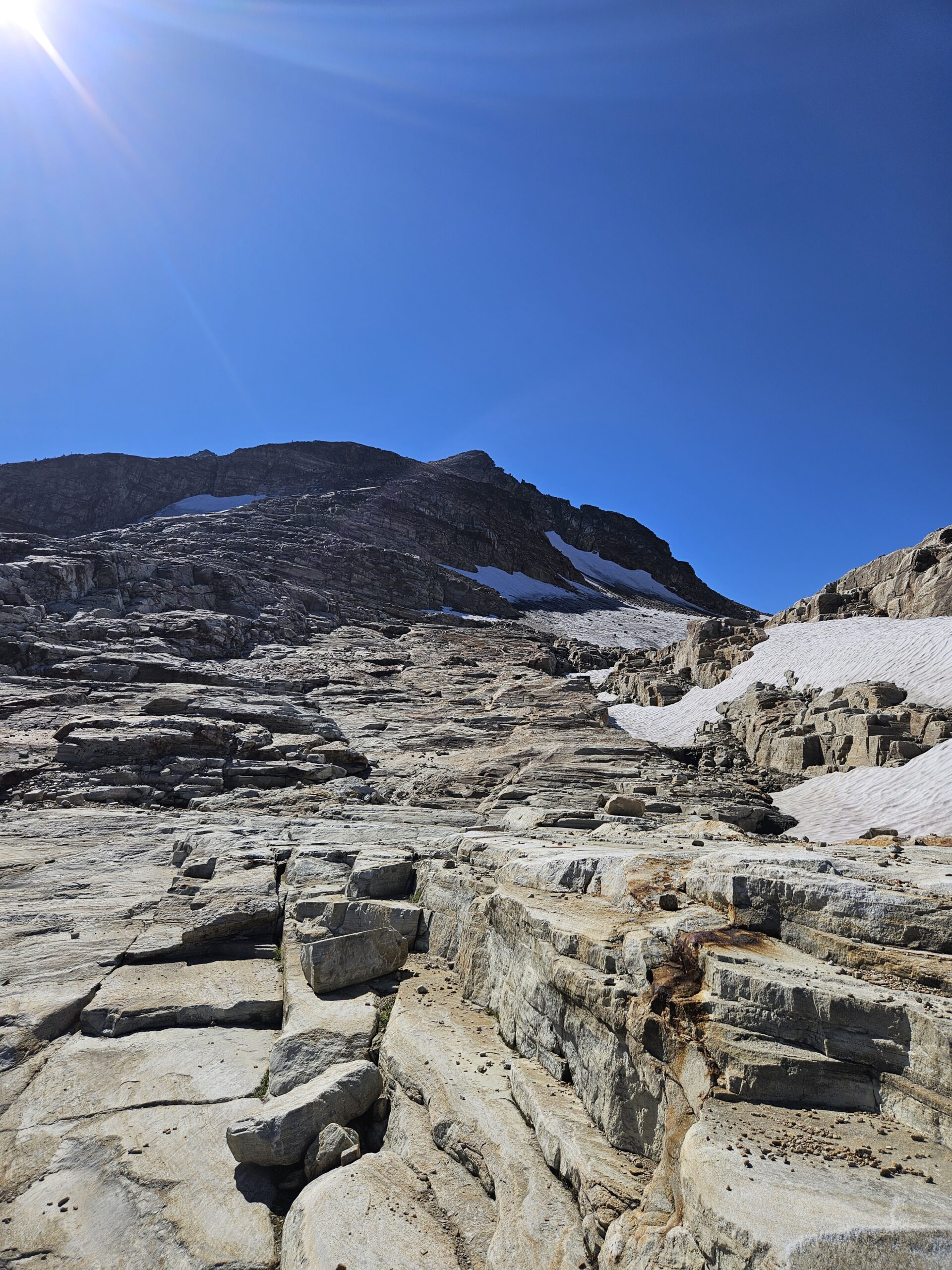
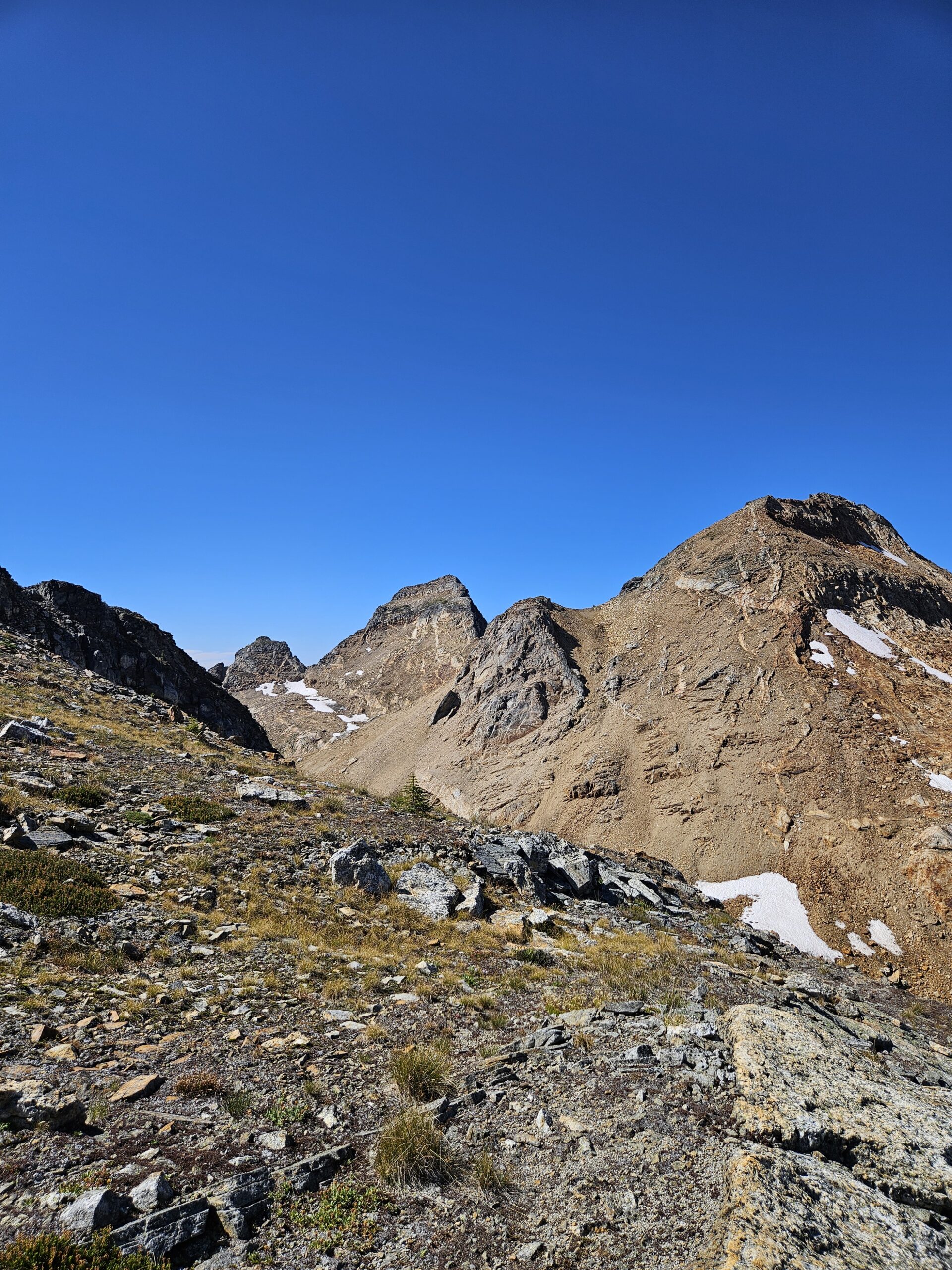
From the lake, the official trail ends, though the path worn by other hikers is easy to follow. From here you can head toward Mount Severide, Sun Peak Mountain, or Pinnacle Peak. AllTrails lists Sun Mountain and includes a line for the Pinnacle scramble, though without a dedicated trail entry. Gaia GPS shows both, and I used it to keep myself on track. Cairns also mark much of the route, and since the rocky terrain is wide open, you can usually pick your own way without much difficulty.
Nature really rolled out the red carpet for us hikers with this scramble. The rock forms natural steps nearly all the way up. It reminded me of the jagged stairs Gollum led Frodo and Sam up in Mordor, thankfully without the Shelob. From the saddle between South Pinnacle and Pinnacle Peak, the views stretch south across the valley and north to Mount Severide, Sun Peak Mountain, and, in the distance, Mount Odin. With no one else around, it was a perfect spot to practice flying my drone. I burned through two batteries, then had a bite to eat before pushing towards the summit.
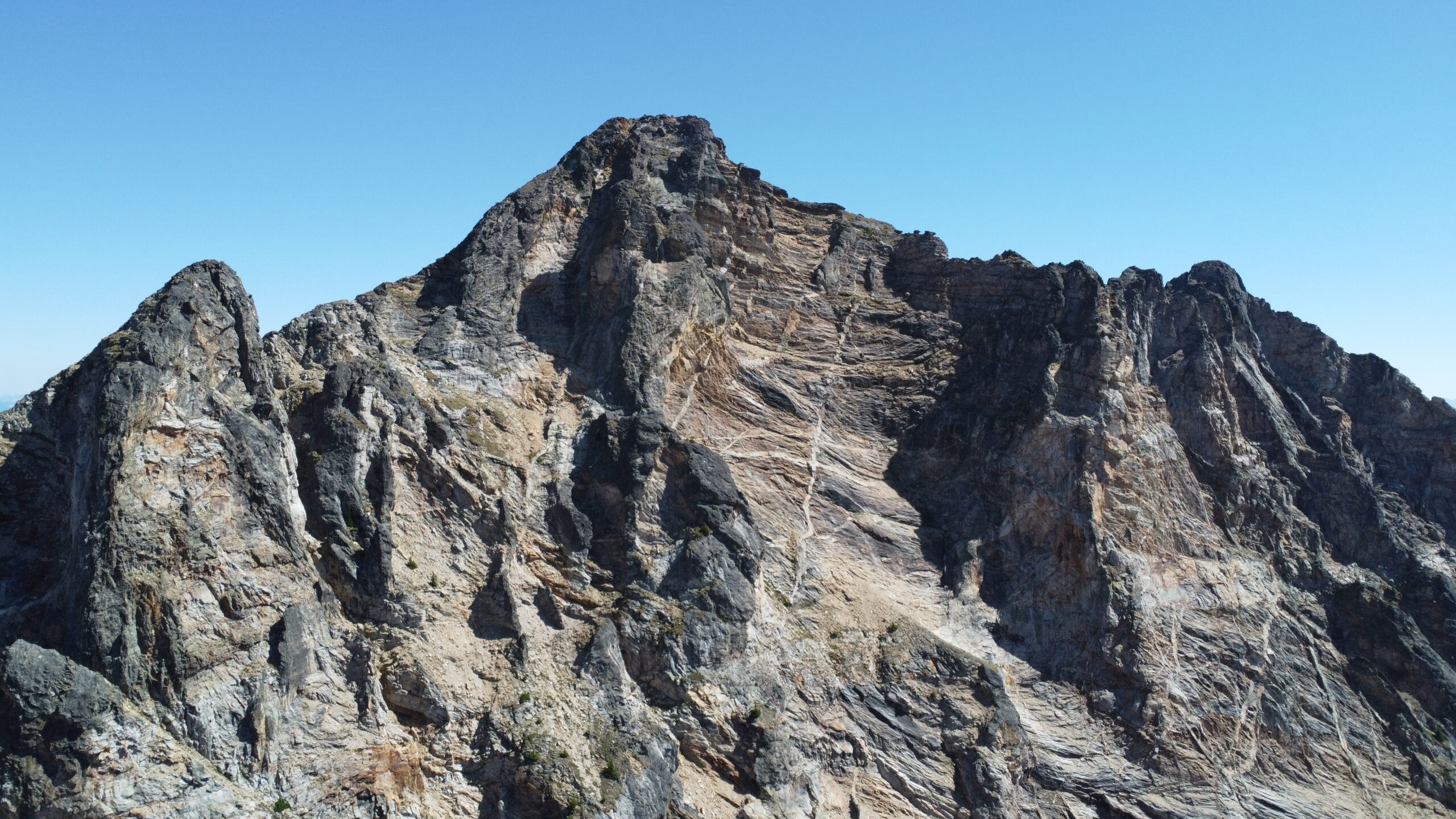
The scrambling grows more exposed near the top. Exposure has always made me uneasy, and I don’t yet have much experience picking the safest route. I managed to push myself within about 10 m of the summit (2,573 m), but the last section was a very exposed ledge. My nerves kicked in hard, and I ultimately decided to turn back rather than risk getting stuck or injured. With more experience, or a partner with me, I think I could have pushed through, but alone I didn’t feel comfortable.
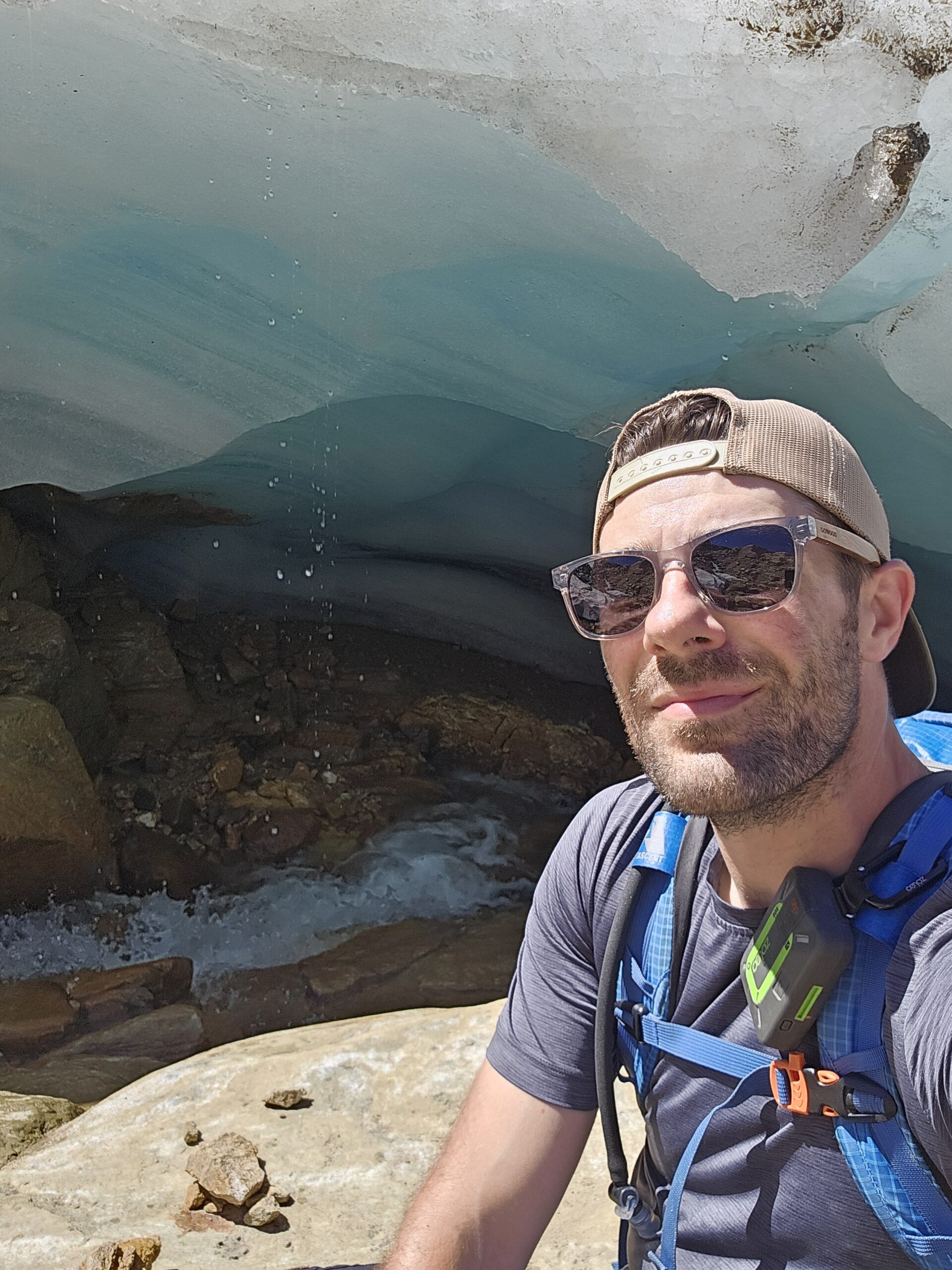
Back on solid ground, I retraced my steps toward the lake, stopping to explore small waterfalls and a mini ice cave formed from glacier melt. The footing can be loose in places, so care is needed, but the terrain is open and navigation straightforward. It took about an hour and a half to descend back to Monashee Lake, where I paused in the shade to escape the now intense heat. A swim would have been perfect, but it was already 3 p.m. and I still needed to hike out and drive to Kamloops, so I pressed on.
The final stretch back to the trailhead was easy to follow, thanks to the flagging and clear path, though tough on my knees. By the time I reached my truck, I was tired but happy. The entire trip took me 9.5 hours car-to-car, covering 21 km and about 1,225 m of elevation gain. I spent roughly two of those hours filming for my YouTube channel, so the outing could be done faster. Still, this hike is rewarding from start to finish. Even if you only went as far as Monashee Lake, it would be worth it. With the option to set up a base camp and explore multiple surrounding peaks, this is an incredible area, and I can’t wait to return to try for Pinnacle’s summit again.
Leave a Reply