

I first heard about Trophy Mountain Meadows in Wells Grey provincial Park near Clearwater a few years ago, but the timing never lined up for me to visit during the wildflower bloom. This year everything fell into place, and as Ricky would say, “get two birds stoned at once,” I decided to spend the weekend camping at Sheila Lake and climbing Trophy Mountain.
I left Kamloops Friday around noon, stopped in Barriere for some food, and rolled into the trailhead parking lot (51.758511, -119.942853) at 2:00 pm. The forest service road was in great condition. I even saw two low sedans driving down, and the lot had plenty of crossovers and C-class campers. Expect about 25 minutes of driving on the FSR after turning off Clearwater Valley Road. On the way up the FSR, I was lucky enough to spot two moose. Unfortunately, I was not able to get photos, I know “pics or it didn’t happen” but I swear I saw them.
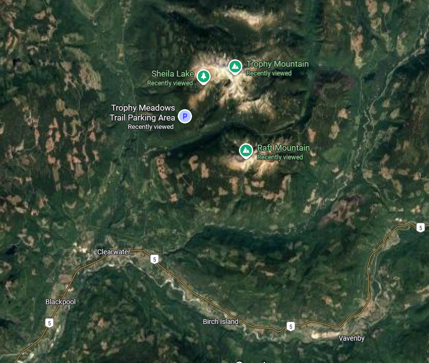
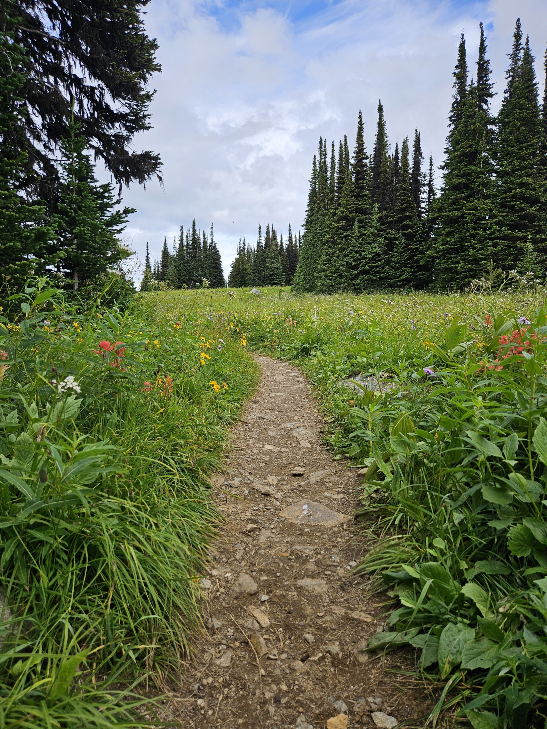
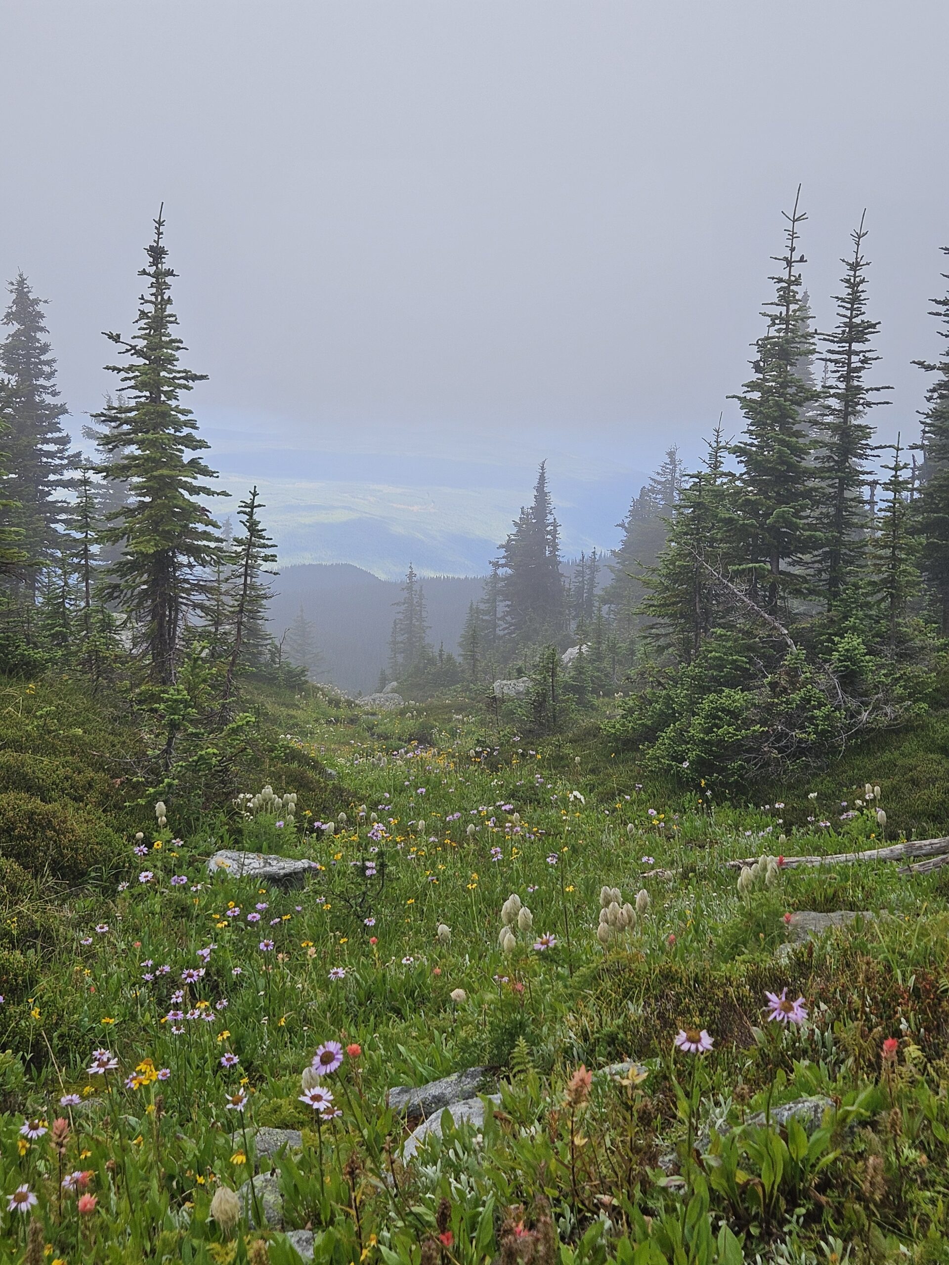
The trailhead starts at 1,682 m. Be sure to pack bear spray because you are in bear country, even though the trail is quite busy it is better to be prepared. It took me about 1.5 hours to reach Sheila Lake campground: 5.9 km and 400 m of elevation gain, though I added some distance walking back and forth filming a YouTube video. The trail is straightforward with roots and rocks in the forest, but once you hit the meadows the footing is much smoother. The wildflowers were in full bloom, swaying beautifully in the sun and wind. The trail is built up enough that there is even an outhouse halfway to the lake.
Sheila Lake sits at 2,053 m (51.788994, -119.917913) and is a picturesque subalpine lake. The campground is well maintained with 20 tent pads, two outhouses, four bear caches, and three cook shacks. Most sites even get cell service, which is handy for peace of mind. Tent pads are raised wood platforms, so bring extra guy lines to secure your tent. The mosquitoes were relentless, so strong bug spray and a mesh face cover kept me from losing my mind. As always, it is pack in and pack out. Store food properly in the caches if you are staying overnight.
After setting up camp, my legs still wanted more, so I took a quick half-hour walk east of Sheila Lake. Just before descending to the lake there is a left turn that leads to a nice viewpoint of Sheila Lake to the north, with great views of Raft Mountain and Dunn Peak to the south. The trail continues on to several smaller alpine lakes above Sheila Lake, which are easy to reach and worth the detour. Dinner was a dehydrated burrito bowl from Mountain Prep Food, a Whistler-based company. It was tasty but be careful of the farts that follow. A small pack of tortillas makes a great addition, since the burrito bowl works perfectly for bush tacos.
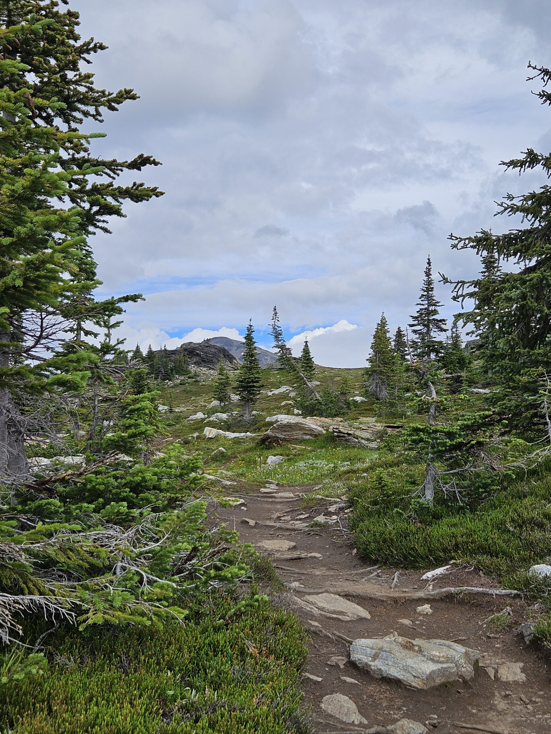
That night I struggled to sleep and was up at 6 am feeling groggy. Breakfast was simple: oats, coffee, and a protein bar. For the climb, I packed extra socks, a poncho, three litres of water, lunch (another dehydrated meal), dried mango, banana chips, and two protein bars. I hit the trail at 7 am, circling around the west end of Sheila Lake past a few unnamed small lakes. From there, the route climbs up Long Hill ridge, which is marked on Gaia GPS and AllTrails. Heading east along the ridge takes you toward the west approach of Trophy Mountain. I took a slightly different line further east before gaining the ridge, but any route works since it is open country with no established trail. Expect some route-finding and plenty of boulder-hopping, and trekking poles are useful. cairns mark parts of the way, and I rebuilt a few that had toppled over.
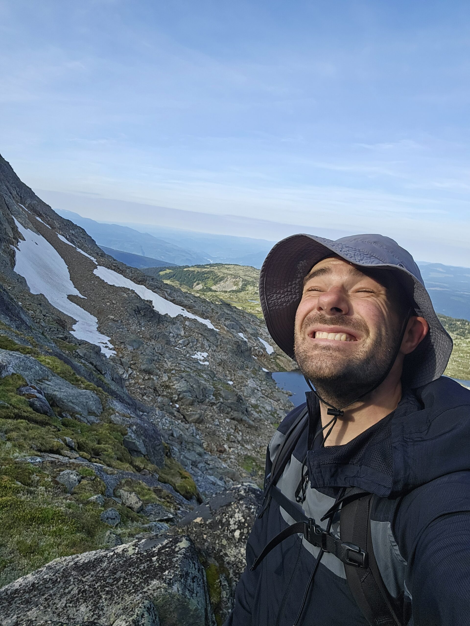
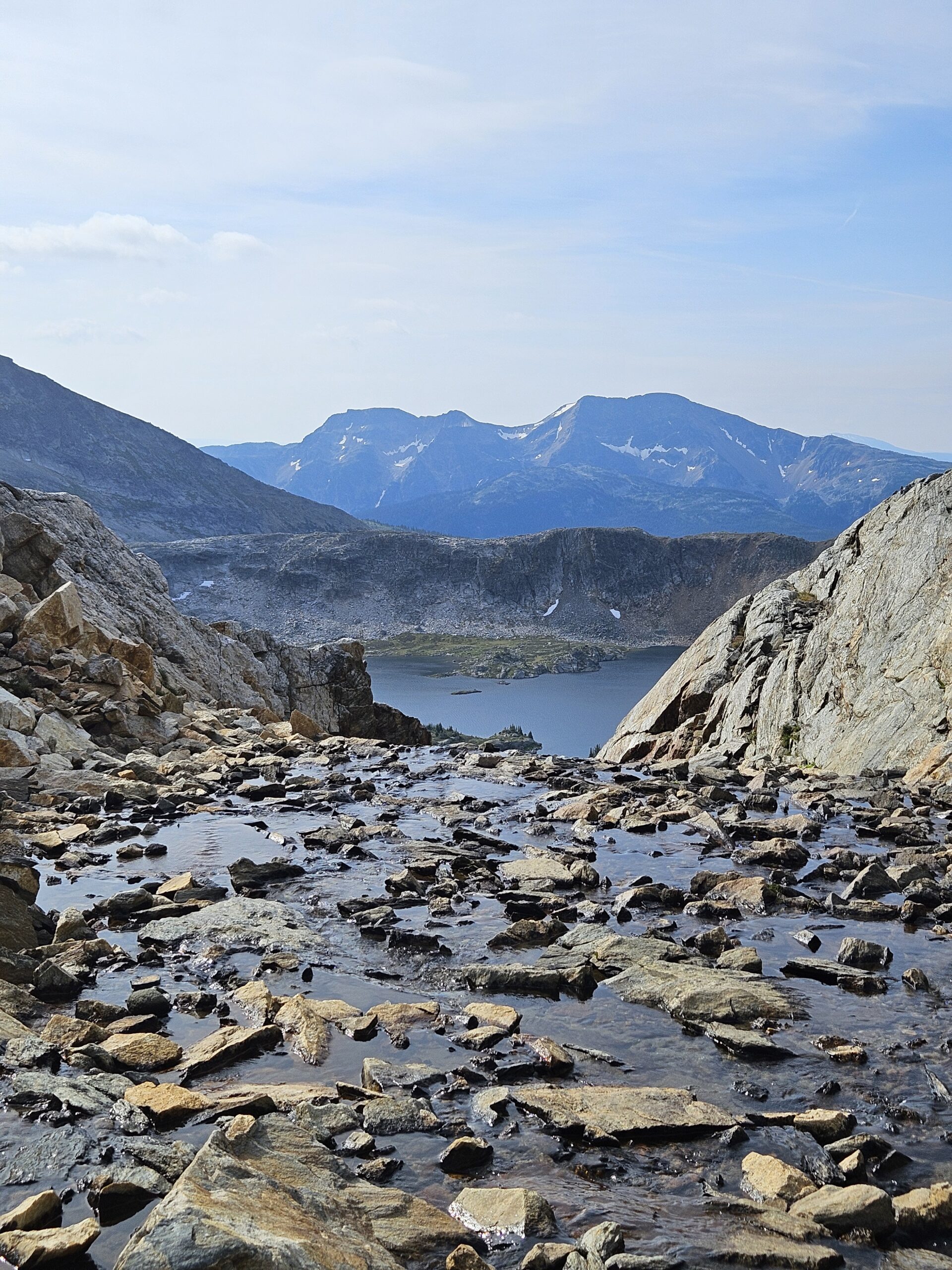
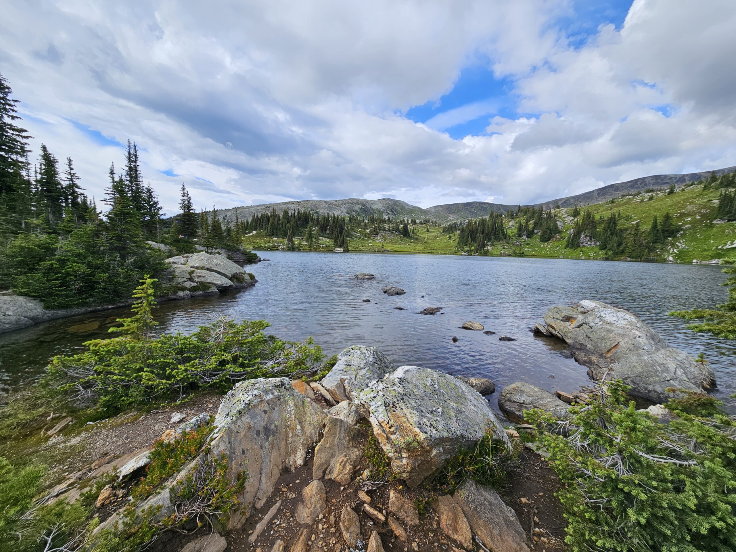
From a distance, the western approach looked steeper than I was comfortable tackling alone, so I dropped down to Cwemcwan Lake at the base of Trophy Mountain. The descent involved loose rock, boulders, and more route-finding, but navigation is straightforward in the open terrain. Cwemcwan Lake makes a perfect stop for a swim and lunch before the final 400 m push to the summit. The ascent is a steady climb over more talus and boulders. It is not exposed, just tiring. By the time I reached the top (2577 m), wildfire smoke had started to roll in, which muted the views. There is a summit register in a log box that is worth checking out.
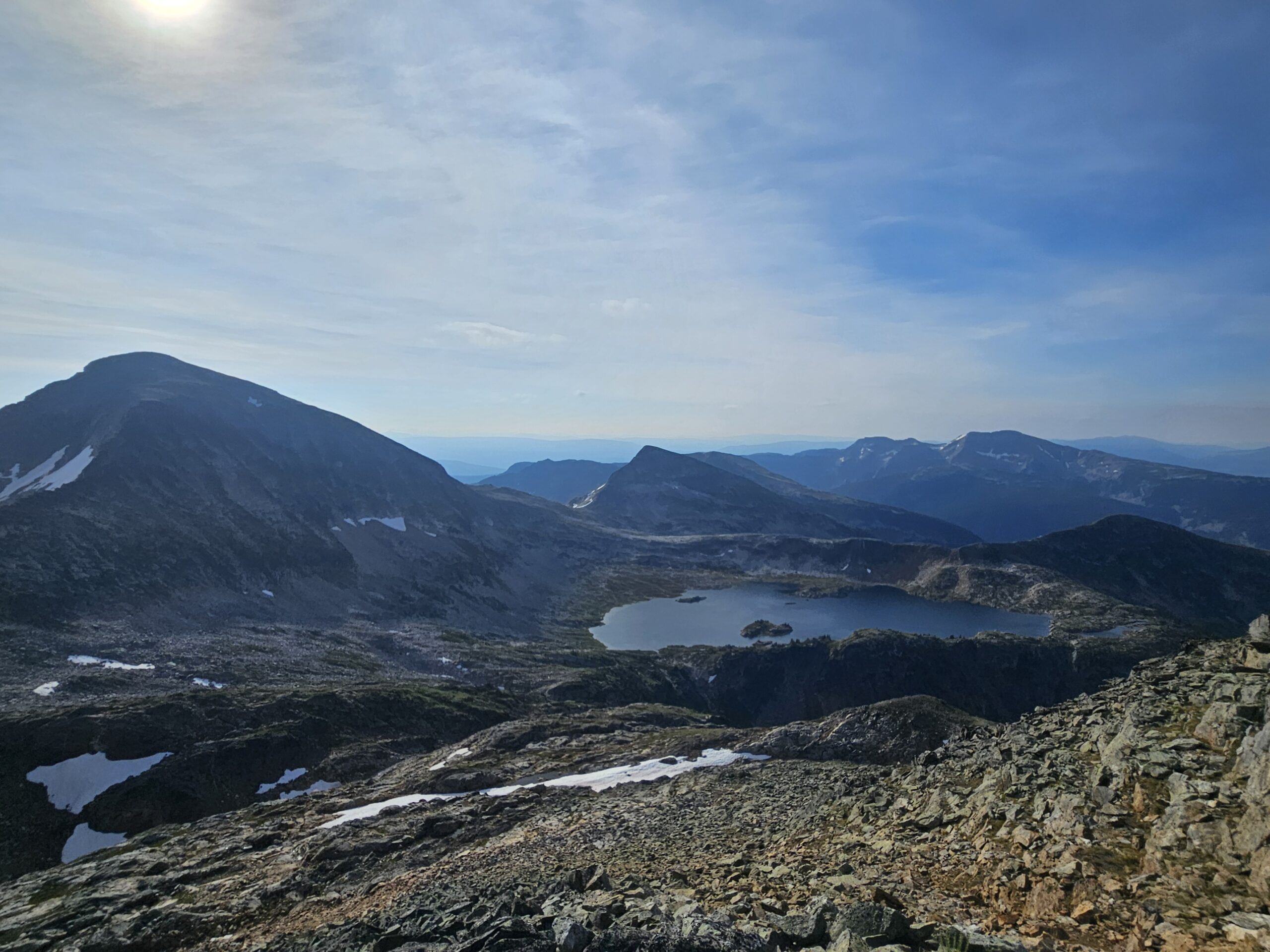
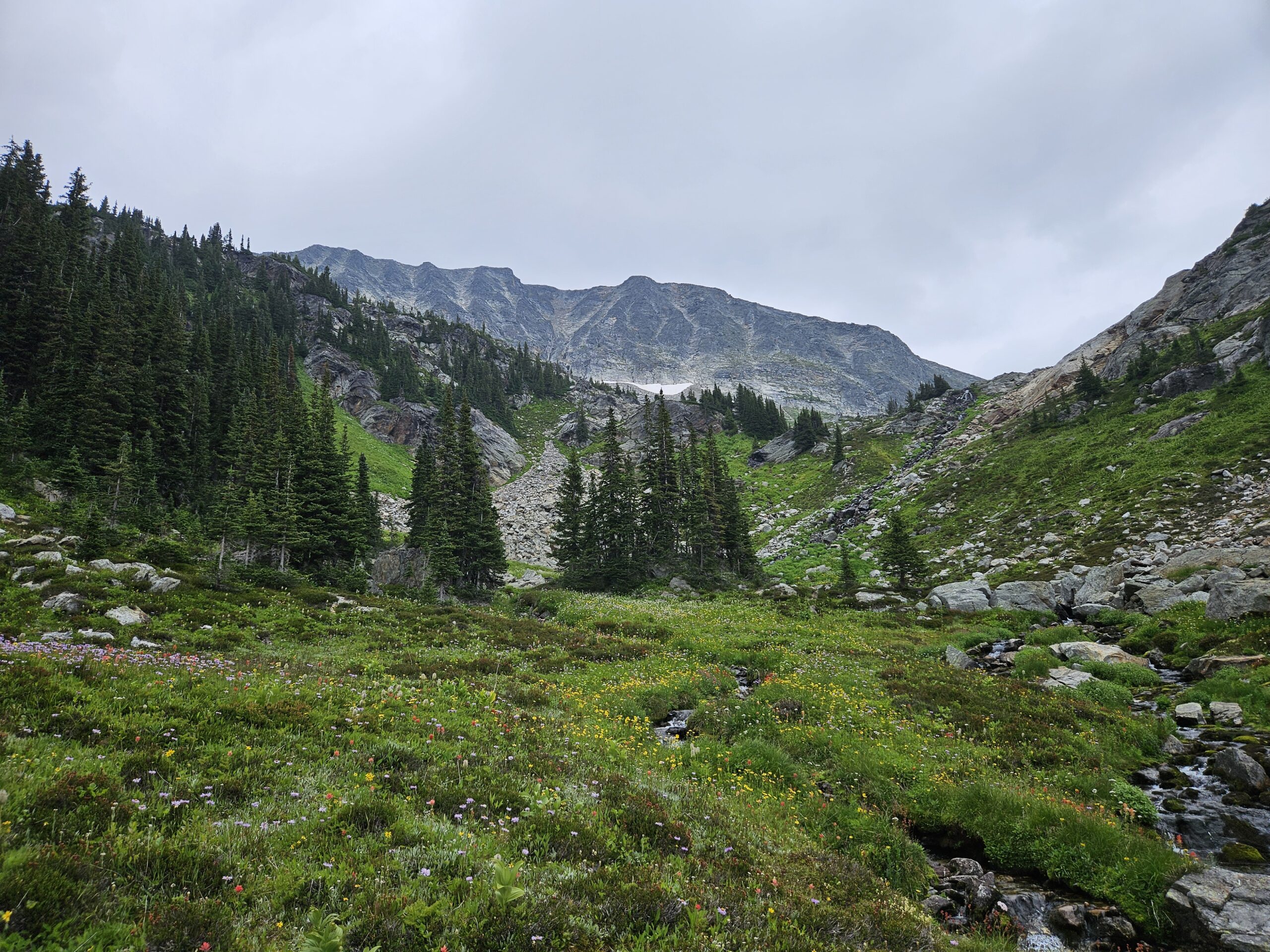
I retraced my steps down to Cwemcwan Lake, sliding down on lingering snow patches to save my awful ankles. Instead of returning the same way, I followed the creek from the north end of Cwemcwan into a wildflower-filled valley. With no one else around and only the sound of water and wind, it felt completely remote. I eventually reached a small lake (51.791688, -119.897659), then slogged up rockfalls on the west side to regain the ridge above Sheila Lake. It was a tough climb after a long day, but once on top it was an easy walk back to camp.
In total, the round trip from tent to summit and back took 7.5 hours and about 20 km. I took two 20-minute breaks and added an extra hour and 2 km running back and forth filming. For me, it was a lot of effort for limited summit views, but still worth it to finally check Trophy Mountain off the list.
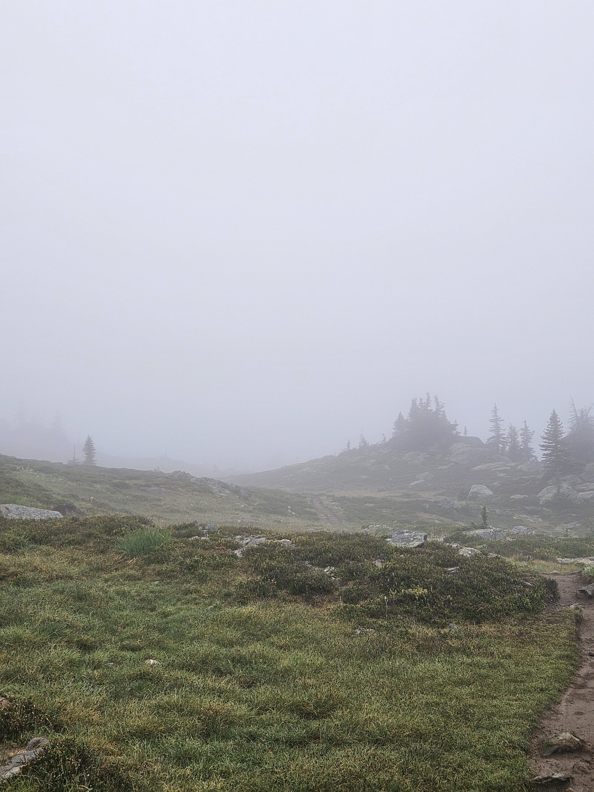
That night I had an early dinner, an underwhelming mango sticky rice dehydrated meal, but fuel nonetheless. I finished my book and packed up as much as I could. Rain moved in overnight, but I stayed warm and dry. In the morning I woke at 7 am to heavy fog that created an eerie, beautiful haze. At 8 am I was hiking out, and by 9:15 I was back at the truck, greeted by sunshine and 23°C weather. My total distance hiked was 32 kilometer with roughly 1800 m of elevation gain.
If you are looking for an easy overnight, Sheila Lake is perfect. It is free, scenic, and well equipped. If you want more adventure, Trophy Mountain makes a great introduction to route-finding. Since there is cell service along the way, it is a safe place to practice without the stress of being completely off-grid.
Leave a Reply