

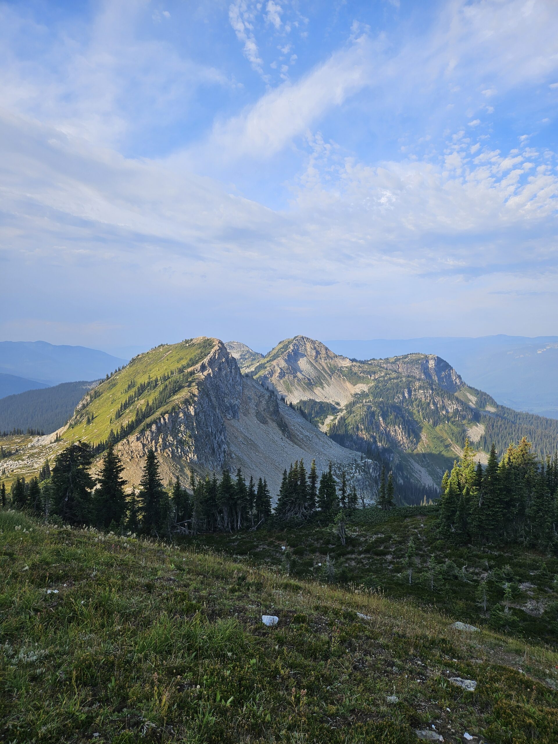
On Labour Day I wanted something a little easier on my legs, since they were still sore from Saturday’s hike and the runs I’d done during the week. As it turned out, Joss Mountain had other plans. While the overall elevation gain was less than what I usually tackle, the trail hits you right away with a 550-meter climb in just 2 km and my legs were feeling it. Still, don’t let that put you off. Once you get above the treeline, the views of the surrounding peaks open up, and cresting the first ridge feels like stepping into a whole new landscape.
To reach the western approach trailhead, turn off Highway 1 onto Wap Lake FSR. Drive 6 km, then make a right at 50.88450, -118.49553. From there, follow the logging road for 10 km to the trailhead at 50.83938, -118.49889. It took me about 35 minutes. The road is unsigned until the trailhead, but both AllTrails and Gaia GPS maps will guide you in. If you’re relying on Google Maps, you’ll need to keep an eye on satellite view. Road conditions are decent overall, with a few rocky corners, but any truck, crossover, or SUV should have no problem making it.
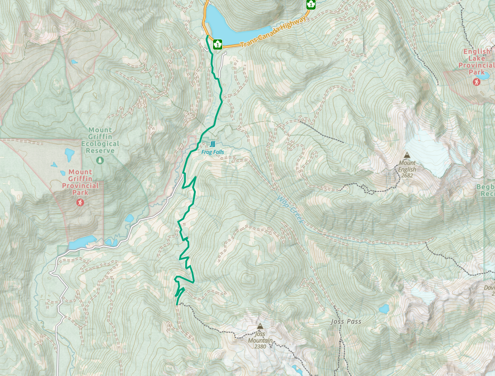
The hike itself starts in a clear-cut section before quickly slipping into forest. The trail is lined with huckleberry bushes, and there were still a few berries left to snack on. Navigation is simple, the path is well maintained, clearly flagged with ribbon, cairns, and tree markers. One important note: there are no water sources along the way, so bring enough to last the whole hike. The forest is dotted with dead trees draped in old man’s beard, but views don’t appear until you break above the treeline. From the first peak onward, the hike transforms, offering sweeping 360-degree views of the Monashees stretching toward Valemount and Cherryville, as well as the Selkirk Mountains and Goat Range.
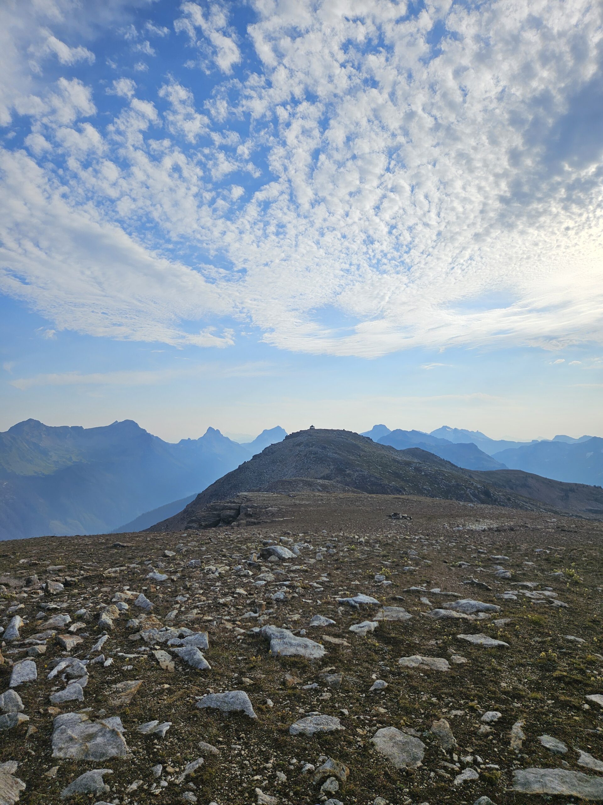
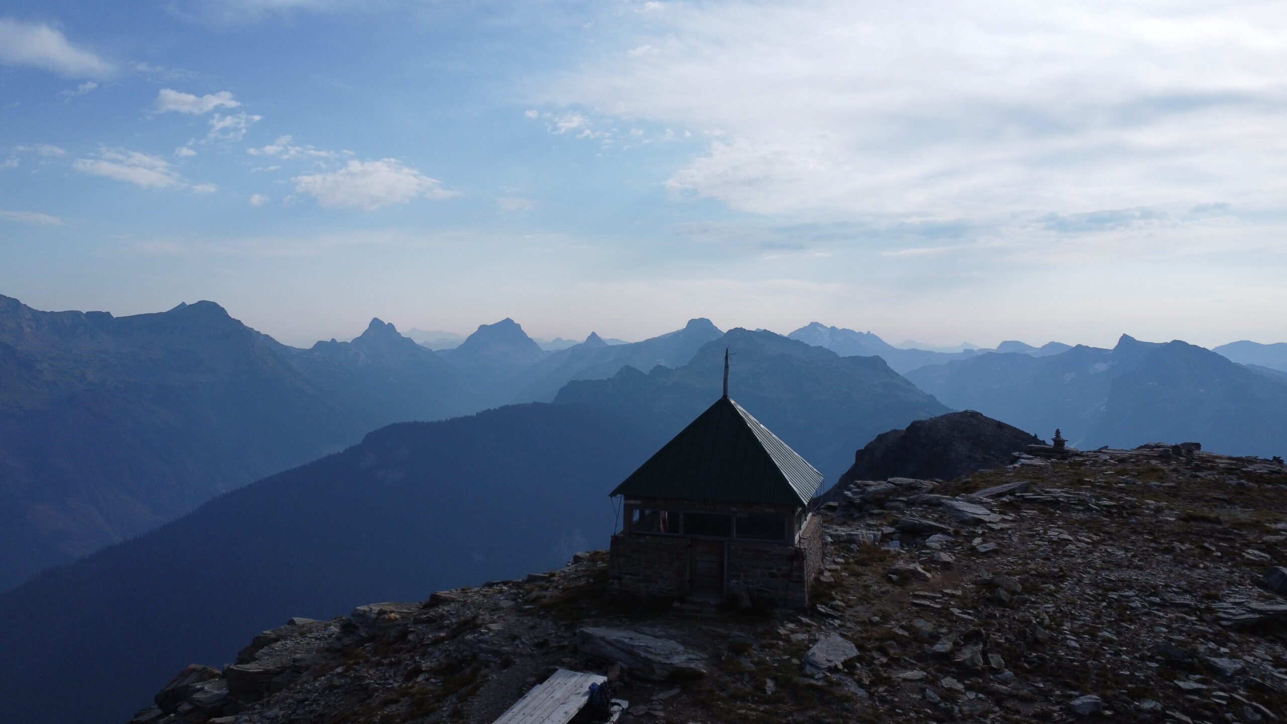
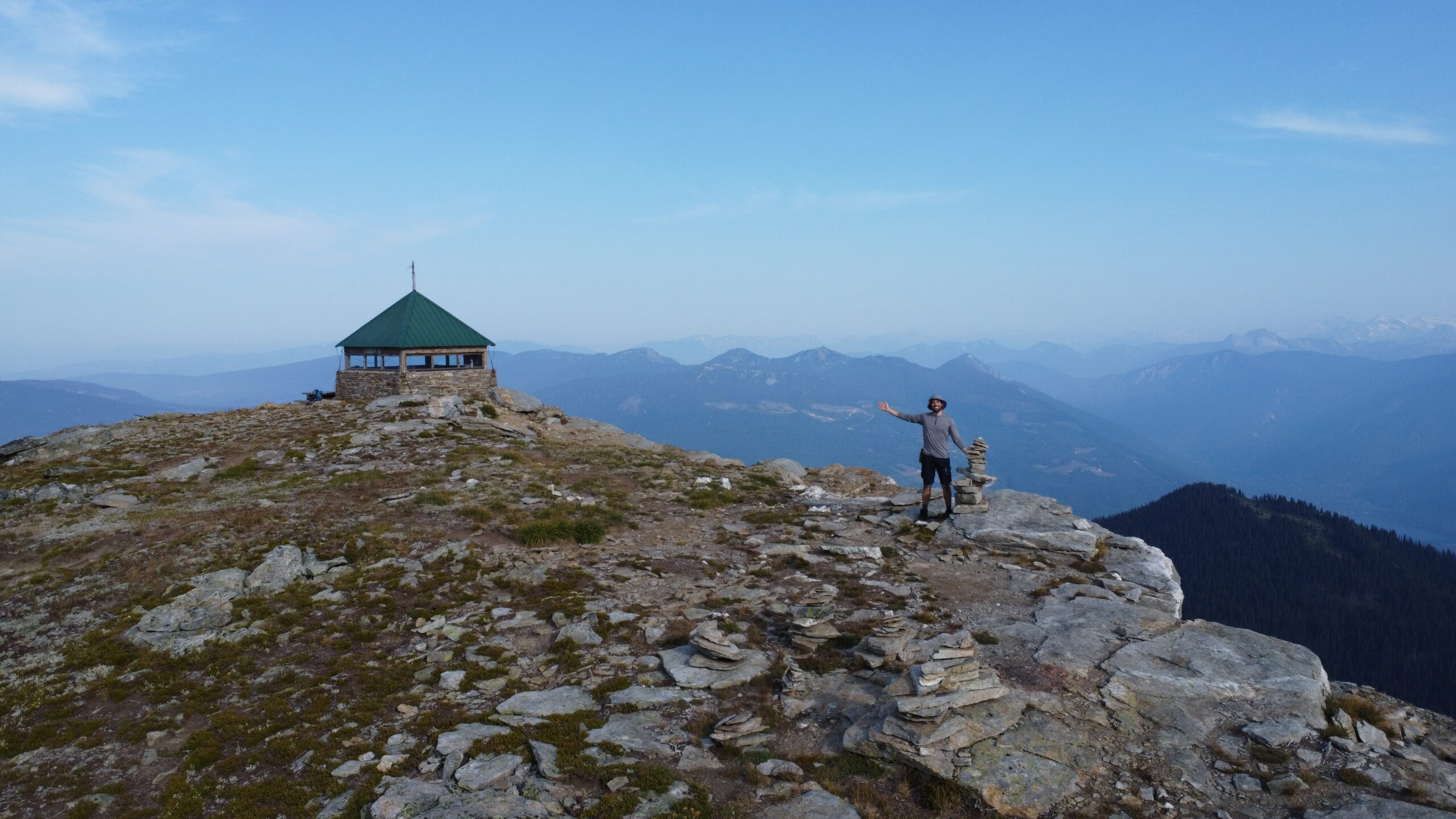
The real highlight, though, is at the summit: a 100-year-old fire lookout. It’s remarkably well preserved, with a logbook inside for hikers to sign. I always enjoy flipping through these to see where others have traveled from. The cabin also holds photos taken from the exact spot back in 1908, along with a laminated history sheet that makes for a quick, fun read. The lookout can be used as a shelter if you choose to stay overnight, please be respectful: pack out everything you bring in and leave it tidy. Outside, there’s a picnic table and fire pit, but no cellphone service anywhere on the hike if that matters to you.
Compared to some of my usual trips, this one was fairly quick. It took me 2 hours 15 minutes to reach the top and just 1 hour 15 minutes to get back down, covering about 10 km and 850 meters of elevation gain. Crowds aren’t really an issue here, I only saw one couple and a family of four on my descent. The effort to reward ratio is excellent. Yes, the initial climb is a grind, but the panoramic views and historic lookout at the summit make it all worthwhile.
Leave a Reply to Chad438 Cancel reply